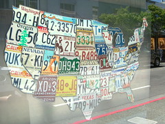
商用無料の写真検索さん


maps

タグをコピペすると、ブログなどにカンタン貼り付けできます。

各画像のライセンスに従って利用してください。被写体の肖像権、商標・意匠登録等にご注意ください。

詳しくはクリエイティブ・コモンズ・ライセンスの利用についてをご覧ください。

M430-2023
M430-2023
by Community Archives of Belleville & Hastings County

No known copyright restrictions(著作権制限なし)

Monon_BlackFork
Monon_BlackFork
by pfly

クリエイティブ・コモンズ 表示-継承 2.1

Where I've been
Where I've been
by drvolisce

クリエイティブ・コモンズ 表示-改変禁止 2.1


Maps
Maps
by Wikimedia Finland

クリエイティブ・コモンズ 表示-継承 2.1

亞洲新灣區 計畫圖 01
亞洲新灣區 計畫圖 01
by 準建築人手札網站 Forgemind ArchiMedia

クリエイティブ・コモンズ 表示 2.1

Metropolitan Area Oakland California: Location of Oakland Business District in Relation to Business Districts of Other Cities (1947)
by Erica _ Fischer

クリエイティブ・コモンズ 表示 2.1


Hambantota
Hambantota
by Sarvodaya Sri Lanka

クリエイティブ・コモンズ 表示 2.1

IMG_3277
IMG_3277
by majcher

クリエイティブ・コモンズ 表示-継承 2.1

Areas with least restrictive existing bulk controls (1971)
by Erica _ Fischer

クリエイティブ・コモンズ 表示 2.1


MAP
MAP
by mmcanellas

クリエイティブ・コモンズ 表示 2.1

Flights in 2011, 33 segments, 94487 miles in total
by Jun Seita

クリエイティブ・コモンズ 表示 2.1

Grand Theft Auto: Chinatown Wars
by Gustavo da Cunha Pimenta

クリエイティブ・コモンズ 表示-継承 2.1


Where streets are most important as sources of light, air, and open space (1971)
by Erica _ Fischer

クリエイティブ・コモンズ 表示 2.1

Location of Proposed Passenger Terminals, Oakland, California (1947)
by Erica _ Fischer

クリエイティブ・コモンズ 表示 2.1

12 Hour Vehicle Cordon Count Comparison of 1934-1937 and 1946, the Central Business District of Oakland California (1947)
by Erica _ Fischer

クリエイティブ・コモンズ 表示 2.1


A Kartográfiai Vállalat szétszedhető földgömbje (1986)
by nemzetikonyvtar

クリエイティブ・コモンズ 表示-継承 2.1

Cleared territory
Cleared territory
by Mellicious

クリエイティブ・コモンズ 表示-改変禁止 2.1

M440-1878
M440-1878
by Community Archives of Belleville & Hastings County

No known copyright restrictions(著作権制限なし)


Bicycle legal "cheat"
by Richard Masoner / Cyclelicious

クリエイティブ・コモンズ 表示-継承 2.1

M430-2041
M430-2041
by Community Archives of Belleville & Hastings County

No known copyright restrictions(著作権制限なし)

Map
Map
by seanhagen

クリエイティブ・コモンズ 表示-継承 2.1


Subway
Subway
by theskinimin

クリエイティブ・コモンズ 表示-改変禁止 2.1

M440-1875
M440-1875
by Community Archives of Belleville & Hastings County

No known copyright restrictions(著作権制限なし)

M440-1818
M440-1818
by Community Archives of Belleville & Hastings County

No known copyright restrictions(著作権制限なし)


MongRogerMap.JPG
MongRogerMap.JPG
by jrubinic

クリエイティブ・コモンズ 表示 2.1

M440-1849
M440-1849
by Community Archives of Belleville & Hastings County

No known copyright restrictions(著作権制限なし)

M430-1847
M430-1847
by Community Archives of Belleville & Hastings County

No known copyright restrictions(著作権制限なし)


SoCal
SoCal
by yonghokim

クリエイティブ・コモンズ 表示-継承 2.1

Richmond Boulevard Freeway (Oakland, 1947)
by Erica _ Fischer

クリエイティブ・コモンズ 表示 2.1

map
map
by Sustainable Economies Law Center

クリエイティブ・コモンズ 表示-継承 2.1


MAP
MAP
by mmcanellas

クリエイティブ・コモンズ 表示 2.1

Locmap-MaurelleIsland
by pfly

クリエイティブ・コモンズ 表示-継承 2.1

M430-1972
M430-1972
by Community Archives of Belleville & Hastings County

No known copyright restrictions(著作権制限なし)


Map
Map
by chidorian

クリエイティブ・コモンズ 表示-継承 2.1

M440-1841
M440-1841
by Community Archives of Belleville & Hastings County

No known copyright restrictions(著作権制限なし)

Map
Map
by scriptingnews

クリエイティブ・コモンズ 表示-継承 2.1


DonbasENG_target-hromadas_updated
by UNDP Ukraine

クリエイティブ・コモンズ 表示-改変禁止 2.1

世界地図
世界地図
by kynbit

クリエイティブ・コモンズ 表示 2.1

M430-1939
M430-1939
by Community Archives of Belleville & Hastings County

No known copyright restrictions(著作権制限なし)


Map of windsor in blue tiles
by Matt From London

クリエイティブ・コモンズ 表示 2.1

May18IM 0600
May18IM 0600
by lagohsep

クリエイティブ・コモンズ 表示-継承 2.1

IMG_3274
IMG_3274
by majcher

クリエイティブ・コモンズ 表示-継承 2.1


map
map
by yearofthebird

クリエイティブ・コモンズ 表示 2.1

Transplanted walks
Transplanted walks
by Erica _ Fischer

クリエイティブ・コモンズ 表示 2.1

traversee FFTT 2013
traversee FFTT 2013
by akunamatata

クリエイティブ・コモンズ 表示-改変禁止 2.1


Locmap-CorderoChannel
by pfly

クリエイティブ・コモンズ 表示-継承 2.1

google maps on my w580
by kalleboo

クリエイティブ・コモンズ 表示 2.1

Me sorting our maps out
by andrew_j_w

クリエイティブ・コモンズ 表示-継承 2.1


blocks-fargo-2016-03-27
by Mulad

クリエイティブ・コモンズ 表示 2.1

Locmap-quadraisland
Locmap-quadraisland
by pfly

クリエイティブ・コモンズ 表示-継承 2.1

中華航空 空中巴士 A340-300 座艙配置圖.jpg
by 準建築人手札網站 Forgemind ArchiMedia

クリエイティブ・コモンズ 表示 2.1


Tablecloth Cartography
by lostajy

クリエイティブ・コモンズ 表示 2.1

2012_1_19_41_49_51898
2012_1_19_41_49_51898
by the pain of fleeting joy

クリエイティブ・コモンズ 表示-継承 2.1

Locmap-RosarioStrait
by pfly

クリエイティブ・コモンズ 表示-継承 2.1


map of Toyama new port
by tsuda

クリエイティブ・コモンズ 表示-継承 2.1

Locmap-BanksIsland
Locmap-BanksIsland
by pfly

クリエイティブ・コモンズ 表示-継承 2.1

paul Revere's ride map1
by jimmie-quickity

クリエイティブ・コモンズ 表示-継承 2.1


Locmap-StuartIsland
Locmap-StuartIsland
by pfly

クリエイティブ・コモンズ 表示-継承 2.1

State map of USA
State map of USA
by Kevin Hutchinson

クリエイティブ・コモンズ 表示 2.1

NHTI
NHTI
by DoctorButtsMD

クリエイティブ・コモンズ 表示-継承 2.1


2,041件~2,100件 (全 126,193件)

(C)名入れギフト.com