商用無料の写真検索さん


maps

タグをコピペすると、ブログなどにカンタン貼り付けできます。

各画像のライセンスに従って利用してください。被写体の肖像権、商標・意匠登録等にご注意ください。

詳しくはクリエイティブ・コモンズ・ライセンスの利用についてをご覧ください。

Mapa de rutas de las Províncias de San Luis y Mendoza (parcial), Argentina.
by thejourney1972 (South America addicted)

クリエイティブ・コモンズ 表示 2.1

Spy Lake Campsites
Spy Lake Campsites
by andyarthur

クリエイティブ・コモンズ 表示 2.1

hepcolor p14
hepcolor p14
by pilllpat (agence eureka)

クリエイティブ・コモンズ 表示-継承 2.1


brunhes geo 47
brunhes geo 47
by pilllpat (agence eureka)

クリエイティブ・コモンズ 表示-継承 2.1

Otter Creek State Forest Campsites
by andyarthur

クリエイティブ・コモンズ 表示 2.1

Certificate of residence for Lu See Len, farmer, age 40 years, of San Jose, California
by California Historical Society Digital Collection

No known copyright restrictions(著作権制限なし)


NORML Mid-Atlantic-Cannabis, Canvas, and Culture
by jonny goldstein

クリエイティブ・コモンズ 表示 2.1

probki
probki
by dudarev

クリエイティブ・コモンズ 表示 2.1

Smoking Status by Ward, Washington, DC USA 51194
by tedeytan

クリエイティブ・コモンズ 表示-継承 2.1


Ashtabula OH 1980
Ashtabula OH 1980
by davecito

クリエイティブ・コモンズ 表示 2.1

Europe
Europe
by Norman B. Leventhal Map Center at the BPL

クリエイティブ・コモンズ 表示 2.1

Woods Lake
Woods Lake
by andyarthur

クリエイティブ・コモンズ 表示 2.1


Map for walk
Map for walk
by noii's

クリエイティブ・コモンズ 表示-継承 2.1

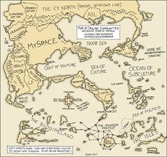
online_communities_Map
by thomcochrane

クリエイティブ・コモンズ 表示 2.1

Ice Thinning and Thickening in Antarctica
by NASA Goddard Photo and Video

クリエイティブ・コモンズ 表示 2.1


Defending Chain Bridge, 1861
by rockcreek

クリエイティブ・コモンズ 表示 2.1

Insurance Plan of the City of Portage La Prairie, Man. June 1959, 26 (1959)
by Historical Maps of Manitoba

クリエイティブ・コモンズ 表示 2.1

Thorne Moor map
Thorne Moor map
by noii's

クリエイティブ・コモンズ 表示-継承 2.1


Metropolitan Winnipeg Types of Manufacturing (1958-59)
by Historical Maps of Manitoba

クリエイティブ・コモンズ 表示 2.1

Cossayuna Lake
Cossayuna Lake
by andyarthur

クリエイティブ・コモンズ 表示 2.1

Belfry Mountain
Belfry Mountain
by andyarthur

クリエイティブ・コモンズ 表示 2.1


gallibellimg (24)
gallibellimg (24)
by pilllpat (agence eureka)

クリエイティブ・コモンズ 表示-継承 2.1

United Kingdom: Population Density, 2000
by SEDACMaps

クリエイティブ・コモンズ 表示 2.1

Kart over verneverdige områder / Trondheims bybilde (1976)
by Trondheim byarkiv

クリエイティブ・コモンズ 表示 2.1


Historic maps of Poland 1844 map 9 of 20
by rich701

クリエイティブ・コモンズ 表示 2.1

Map of Caledonia County, Vermont
by Norman B. Leventhal Map Center at the BPL

クリエイティブ・コモンズ 表示 2.1

Newton near Withlacoochee and Little River watersheds
by WWALS Watershed Coalition

クリエイティブ・コモンズ 表示 2.1


Our global team
Our global team
by Global X

クリエイティブ・コモンズ 表示 2.1

Daytona Beach FL 1961
by davecito

クリエイティブ・コモンズ 表示 2.1

Texas Falls
Texas Falls
by andyarthur

クリエイティブ・コモンズ 表示 2.1


guangzhou-map-centre
by Metro Webzine of China

クリエイティブ・コモンズ 表示-継承 2.1

Buck Mountain
Buck Mountain
by andyarthur

クリエイティブ・コモンズ 表示 2.1

BikeTripMap
BikeTripMap
by Chas Redmond

クリエイティブ・コモンズ 表示 2.1


廖偉立建築師 - 葉毓繡美術館 sketches 044 - 廖偉立建築師手繪稿.jpg
by 準建築人手札網站 Forgemind ArchiMedia

クリエイティブ・コモンズ 表示 2.1

Waterloo IA 1955
Waterloo IA 1955
by davecito

クリエイティブ・コモンズ 表示 2.1

jockeybush Lake
jockeybush Lake
by andyarthur

クリエイティブ・コモンズ 表示 2.1


Joseph Davis State Park
by andyarthur

クリエイティブ・コモンズ 表示 2.1

US-789 Re-Imagined
US-789 Re-Imagined
by LandRover164

クリエイティブ・コモンズ 表示 2.1

2009_01_27_bos-sfo_466
by dsearls

クリエイティブ・コモンズ 表示-継承 2.1


Military map of Maryland & Virginia
by Norman B. Leventhal Map Center at the BPL

クリエイティブ・コモンズ 表示 2.1

Map of today
Map of today
by clhendricksbc

クリエイティブ・コモンズ 表示 2.1

Proposed Scheme of Development at Upper Pinawa (1914)
by Historical Maps of Manitoba

クリエイティブ・コモンズ 表示 2.1


Map of the island
Map of the island
by cifraser1

クリエイティブ・コモンズ 表示 2.1

Capitol to Gallaudet
by Korean Resource Center 민족학교

クリエイティブ・コモンズ 表示-改変禁止 2.1

Climate Zones, Scenario B2 2001 - 2025, Asia
by SEDACMaps

クリエイティブ・コモンズ 表示 2.1


klondike
klondike
by sam_churchill

クリエイティブ・コモンズ 表示 2.1

ancient_mongol_kitan_state
by canada-mongolia

クリエイティブ・コモンズ 表示 2.1

Proposed Scheme of Development at Du Bonnet Falls (1914)
by Historical Maps of Manitoba

クリエイティブ・コモンズ 表示 2.1


Tarana tehsil, Ujjain district, Madhya Pradesh, India
by Ram Prakash Sariwan

クリエイティブ・コモンズ 表示-継承 2.1

langage des lignes 019
by pilllpat (agence eureka)

クリエイティブ・コモンズ 表示 2.1

Visualization of Jim Groom's talk
by MrGluSniffer

クリエイティブ・コモンズ 表示 2.1


Making Maps in QGIS
Making Maps in QGIS
by andyarthur

クリエイティブ・コモンズ 表示 2.1

MiNe-220HS_101-2144R
by MiNe (sfmine79)

クリエイティブ・コモンズ 表示 2.1

New Zealand Road Trip www.apairandasparediy.com
by apairandaspare

クリエイティブ・コモンズ 表示 2.1


English settlers Map
by vastateparksstaff

クリエイティブ・コモンズ 表示 2.1

Ferris Lake
Ferris Lake
by andyarthur

クリエイティブ・コモンズ 表示 2.1

Valley Gardens 01-03-2014
by Karen Roe

クリエイティブ・コモンズ 表示 2.1


Preliminary Throughfare Plan, Northwesterly Section, Santa Clara County, California (1952)
by Erica _ Fischer

クリエイティブ・コモンズ 表示 2.1

Fort Myers FL 1970s
Fort Myers FL 1970s
by davecito

クリエイティブ・コモンズ 表示 2.1

Norcal Crash Map: Memorial Day Weekend 2012
by Richard Masoner / Cyclelicious

クリエイティブ・コモンズ 表示-継承 2.1


781件~840件 (全 126,383件)

(C)名入れギフト.com