商用無料の写真検索さん


maps

タグをコピペすると、ブログなどにカンタン貼り付けできます。

各画像のライセンスに従って利用してください。被写体の肖像権、商標・意匠登録等にご注意ください。

詳しくはクリエイティブ・コモンズ・ライセンスの利用についてをご覧ください。

New York City: Population Density in 10 meter Low Elevation Coastal Zones (LECZ)
by SEDACMaps

クリエイティブ・コモンズ 表示 2.1

London Underground (Day 154 of 366)
by Gene Hunt

クリエイティブ・コモンズ 表示 2.1

Allegany State Park Overview
by andyarthur

クリエイティブ・コモンズ 表示 2.1


Mapa de rutas de las Províncias de Chubut y Santa Cruz (parcial), Argentina.
by thejourney1972 (South America addicted)

クリエイティブ・コモンズ 表示 2.1

manege1
manege1
by pilllpat (agence eureka)

クリエイティブ・コモンズ 表示 2.1

Office decor: 1942 "World War" map distributed through hardware stores. #history #maps #ww2
by AJ Gulyas

クリエイティブ・コモンズ 表示 2.1


Map of the geographic distribution and intradomiciliary prevalences of villages analyzed.
by OpenBioMedical.com

クリエイティブ・コモンズ 表示 2.1

Kopparkaveln Oskar 100515 puls
by oskarlin

クリエイティブ・コモンズ 表示-継承 2.1

Linguistically Isolated Households: 1990
by SEDACMaps

クリエイティブ・コモンズ 表示 2.1


Knoxville TN 1982
Knoxville TN 1982
by davecito

クリエイティブ・コモンズ 表示 2.1

Brutele: AS 12392
Brutele: AS 12392
by faul

クリエイティブ・コモンズ 表示 2.1

Les Isles Britanniques, qui comprennent les Royaumes d'Angleterre, d'Ecosse et d'Irlande
by Norman B. Leventhal Map Center at the BPL

クリエイティブ・コモンズ 表示 2.1


Map of the New York to Paris Automobile Race
by brewbooks

クリエイティブ・コモンズ 表示-継承 2.1

Old Clallam County Washington map
by brewbooks

クリエイティブ・コモンズ 表示-継承 2.1

Lake Algounquin
Lake Algounquin
by andyarthur

クリエイティブ・コモンズ 表示 2.1


Map of the state of Wisconsin
by Norman B. Leventhal Map Center at the BPL

クリエイティブ・コモンズ 表示 2.1

Burnt-Rossman Hills State Forest
by andyarthur

クリエイティブ・コモンズ 表示 2.1

rangoon_event_map
rangoon_event_map
by 1LtCap

クリエイティブ・コモンズ 表示-改変禁止 2.1


An accurate map of North America, drawn from the best modern maps and charts and regulated by Aston'l Observat'ns.
by UBC Library Digitization Centre

No known copyright restrictions(著作権制限なし)

Map of Iwo Jima, 1945
by Archives Branch, USMC History Division

クリエイティブ・コモンズ 表示 2.1

Design Assignments 2010 Higher Grade Product Design * Michael 70/70
by Jordanhill School D&T Dept

クリエイティブ・コモンズ 表示 2.1


2016 Democratic Presidential Primary - Hillary Clinton Minus Bernie Sanders
by andyarthur

クリエイティブ・コモンズ 表示 2.1

Walling and Gray's map of the United States and territories
by Norman B. Leventhal Map Center at the BPL

クリエイティブ・コモンズ 表示 2.1

Belize: Population Density and Low Elevation Coastal Zones
by SEDACMaps

クリエイティブ・コモンズ 表示 2.1


DB map
DB map
by sfllaw

クリエイティブ・コモンズ 表示-継承 2.1

The North Spit of Coos Bay
by BLM Oregon & Washington

クリエイティブ・コモンズ 表示 2.1

Bradford Map 1929
Bradford Map 1929
by RdrBerry

クリエイティブ・コモンズ 表示 2.1


U.S Military Forces in Bosnia - Operation Joint Endeavor
by expertinfantry

クリエイティブ・コモンズ 表示 2.1

Mapa histórico del Paraguay, Chile & "Tierras Magallánicas" (1792)
by thejourney1972 (South America addicted)

クリエイティブ・コモンズ 表示 2.1

Sanford Lake
Sanford Lake
by andyarthur

クリエイティブ・コモンズ 表示 2.1


brunhes geo 17
brunhes geo 17
by pilllpat (agence eureka)

クリエイティブ・コモンズ 表示-継承 2.1

Population Density 2010, Asia
by SEDACMaps

クリエイティブ・コモンズ 表示 2.1

Bike route compare: Google vs MapQuest
by Richard Masoner / Cyclelicious

クリエイティブ・コモンズ 表示-継承 2.1


North Cambridge
North Cambridge
by hober

クリエイティブ・コモンズ 表示-継承 2.1

Mapa XII Región (Magallanes), Chile
by thejourney1972 (South America addicted)

クリエイティブ・コモンズ 表示 2.1

105 América del Sur
105 América del Sur
by thejourney1972 (South America addicted)

クリエイティブ・コモンズ 表示 2.1


Wood River Wetland
Wood River Wetland
by BLM Oregon & Washington

クリエイティブ・コモンズ 表示 2.1

Loon Lake Recreation Area
by BLM Oregon & Washington

クリエイティブ・コモンズ 表示 2.1

Mapa do concelho de Figueiró dos Vinhos, 200-? (Portugal)
by Biblioteca Municipal de Figueiró dos Vinhos

クリエイティブ・コモンズ 表示 2.1


RUTA 221 SAN JAVIER DERECHO
by Secretaría de Movilidad de Medellín

クリエイティブ・コモンズ 表示 2.1

RUTA 069 SAN JOSE JARDIN
by Secretaría de Movilidad de Medellín

クリエイティブ・コモンズ 表示 2.1

Map of the State of New York
by Norman B. Leventhal Map Center at the BPL

クリエイティブ・コモンズ 表示 2.1


Stockport Middle Ground
by andyarthur

クリエイティブ・コモンズ 表示 2.1

Spy Lake Campsites
Spy Lake Campsites
by andyarthur

クリエイティブ・コモンズ 表示 2.1

Close-up of map showing Southern islands including Pulau Satumu / Raffles Lighthouse
by Jnzl's Photos

クリエイティブ・コモンズ 表示 2.1


Alsea Falls Recreation Site
by BLM Oregon & Washington

クリエイティブ・コモンズ 表示 2.1

fripounet16
fripounet16
by pilllpat (agence eureka)

クリエイティブ・コモンズ 表示-継承 2.1

Otter Creek State Forest Campsites
by andyarthur

クリエイティブ・コモンズ 表示 2.1


Smoking Status by Ward, Washington, DC USA 51194
by tedeytan

クリエイティブ・コモンズ 表示-継承 2.1

This is a map of Nairobi, Kenya.
by timbrauhn

クリエイティブ・コモンズ 表示 2.1

"Naturschutzgebiet Wutachschlucht": Map and our way
by tillwe

クリエイティブ・コモンズ 表示-継承 2.1


Stuart FL 1974
Stuart FL 1974
by davecito

クリエイティブ・コモンズ 表示 2.1

Oh No-Guadalajara Won't Do Now
by davecito

クリエイティブ・コモンズ 表示 2.1

Map of Cedar Breaks National Monument, Utah 1
by James St. John

クリエイティブ・コモンズ 表示 2.1


Map for walk
Map for walk
by noii's

クリエイティブ・コモンズ 表示-継承 2.1

Twin Lakes Recreation Area
by BLM Oregon & Washington

クリエイティブ・コモンズ 表示 2.1

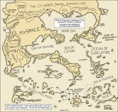
online_communities_Map
by thomcochrane

クリエイティブ・コモンズ 表示 2.1


Map of the town of Marlborough
by Norman B. Leventhal Map Center at the BPL

クリエイティブ・コモンズ 表示 2.1

Defending Chain Bridge, 1861
by rockcreek

クリエイティブ・コモンズ 表示 2.1

Priory Country Park, Bedford - map of GreenWheel cycle route
by Sludge G

クリエイティブ・コモンズ 表示-継承 2.1


721件~780件 (全 116,104件)

(C)名入れギフト.com