商用無料の写真検索さん


mapped

タグをコピペすると、ブログなどにカンタン貼り付けできます。

各画像のライセンスに従って利用してください。被写体の肖像権、商標・意匠登録等にご注意ください。

詳しくはクリエイティブ・コモンズ・ライセンスの利用についてをご覧ください。

ACEO Map 3
ACEO Map 3
by Anattame101

クリエイティブ・コモンズ 表示 2.1

map
map
by rick

クリエイティブ・コモンズ 表示 2.1

APPLE WATCH SPORTS
APPLE WATCH SPORTS
by shinya

クリエイティブ・コモンズ 表示-改変禁止 2.1


MAP OF THE CITY OF OAKLAND, BERKELEY, OAKLAND AND BROOKLYN TOWNSHIPS AND ALAMEDA. 188-
by mk30

クリエイティブ・コモンズ 表示 2.1

11267925_854952074559045_17209043637911307_n
by Masa__Israel

クリエイティブ・コモンズ 表示-改変禁止 2.1

map
map
by Unsworn

クリエイティブ・コモンズ 表示-継承 2.1


Crystal Mall (Waterford, Connecticut)
by jjbers

クリエイティブ・コモンズ 表示 2.1

Cool Gmail-Google Maps rendering bug
by Brett L.

クリエイティブ・コモンズ 表示-継承 2.1

1957 Belleville Fire Insurance Map, Page 16-2
by Community Archives of Belleville & Hastings County

No known copyright restrictions(著作権制限なし)


Map of San Francisco showing the location of the different Distributing Reservoirs of the Spring Valley Water Works (1876-77)
by Erica _ Fischer

クリエイティブ・コモンズ 表示 2.1

Africa
Africa
by residentevil_stars2001

クリエイティブ・コモンズ 表示 2.1

MAP
MAP
by Jean-Louis ZIMMERMANN

クリエイティブ・コモンズ 表示 2.1


Map of Fort Stevens
Map of Fort Stevens
by daveynin

クリエイティブ・コモンズ 表示 2.1

1957 Belleville Fire Insurance Map, Page 16-1
by Community Archives of Belleville & Hastings County

No known copyright restrictions(著作権制限なし)

San Francisco Thoroughfares Plan (1972)
by Erica _ Fischer

クリエイティブ・コモンズ 表示 2.1


treasure map
treasure map
by Leonard J Matthews

クリエイティブ・コモンズ 表示-改変禁止 2.1

Vacant housing in the San Francisco Bay Area, Census 2010
by Erica _ Fischer

クリエイティブ・コモンズ 表示 2.1

cloverleaf
cloverleaf
by breki74

クリエイティブ・コモンズ 表示-継承 2.1


salt dough map with flags (26)
by jimmie-quickity

クリエイティブ・コモンズ 表示-継承 2.1

Katmai National Park and Preserve
by KatmaiNPS

クリエイティブ・コモンズ 表示 2.1

Shift in photo location popularity over time: New York
by Erica _ Fischer

クリエイティブ・コモンズ 表示 2.1


vatican museum map gallery
by Mark B. Schlemmer

クリエイティブ・コモンズ 表示 2.1

united states of america - Google Maps_1265127993764
by William Notowidagdo

クリエイティブ・コモンズ 表示 2.1

David Rumsey map collection
by rhodes

クリエイティブ・コモンズ 表示-継承 2.1


Yucatan 1981 travels sketch map
by Infrogmation

クリエイティブ・コモンズ 表示 2.1

In print!
In print!
by Erica _ Fischer

クリエイティブ・コモンズ 表示 2.1

KEY MAP CENSUS TRACTS AND ECONOMIC AREAS OAKLAND CALIFORNIA (1936)
by mk30

クリエイティブ・コモンズ 表示 2.1


Lacounty-painted-raw_numbers-enlarged-combined
by yonghokim

クリエイティブ・コモンズ 表示-継承 2.1

David Rumsey map collection
by rhodes

クリエイティブ・コモンズ 表示-継承 2.1

1957 Belleville Fire Insurance Map, Page 23-6
by Community Archives of Belleville & Hastings County

No known copyright restrictions(著作権制限なし)


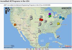
US AE Programs 20080620
by AEngineer

クリエイティブ・コモンズ 表示-継承 2.1

map
map
by Upupa4me

クリエイティブ・コモンズ 表示-継承 2.1

map
map
by uberculture

クリエイティブ・コモンズ 表示 2.1


Map for Sally
Map for Sally
by whatleydude

クリエイティブ・コモンズ 表示 2.1

2012 version of Waldameer maps
by daveynin

クリエイティブ・コモンズ 表示 2.1

OpenStreetMap GPS trace density in and near Europe
by Erica _ Fischer

クリエイティブ・コモンズ 表示 2.1


Comprehensive Plan of San Francisco: Staged Program for Rapid Transit Development (1971)
by Erica _ Fischer

クリエイティブ・コモンズ 表示 2.1

Map
Map
by Sam Howzit

クリエイティブ・コモンズ 表示 2.1

map
map
by jibunkaiwai

クリエイティブ・コモンズ 表示 2.1


San Francisco population density by block (2006)
by Erica _ Fischer

クリエイティブ・コモンズ 表示 2.1

Window Pane over Map
by PinkMoose

クリエイティブ・コモンズ 表示 2.1

2022-040-12-02
2022-040-12-02
by Community Archives of Belleville & Hastings County

No known copyright restrictions(著作権制限なし)


img284
img284
by daves_archive _inactive at current time

クリエイティブ・コモンズ 表示 2.1

Annotated Tumwater Canyon Map
by Laurel Fan

クリエイティブ・コモンズ 表示-継承 2.1

2023-036-07
2023-036-07
by Community Archives of Belleville & Hastings County

No known copyright restrictions(著作権制限なし)


California Interstate Highway System (October, 1959) with original Interstate highway numbering
by Erica _ Fischer

クリエイティブ・コモンズ 表示 2.1

Map of San Francisco Showing Location of Proposed Park and Promenade (1865?)
by Erica _ Fischer

クリエイティブ・コモンズ 表示 2.1

MAP OF THE CITY OF OAKLAND, BERKELEY, OAKLAND AND BROOKLYN TOWNSHIPS AND ALAMEDA. 188-
by mk30

クリエイティブ・コモンズ 表示 2.1


map_tokyo_asakusa
map_tokyo_asakusa
by jwalsh

クリエイティブ・コモンズ 表示 2.1

map of okutama
map of okutama
by jetalone

クリエイティブ・コモンズ 表示 2.1

HC05056
HC05056
by Community Archives of Belleville & Hastings County

No known copyright restrictions(著作権制限なし)


Trail map Rossberg
Trail map Rossberg
by vasile23

クリエイティブ・コモンズ 表示 2.1

Bay Area Rapid Transit District Marin Line (1961)
by Erica _ Fischer

クリエイティブ・コモンズ 表示 2.1

img263
img263
by daves_archive _inactive at current time

クリエイティブ・コモンズ 表示 2.1


Mapa de la Carretera Austral: tramos Chaitén hacia Caleta Gonzalo + Hornopirén hacia Caleta Puelche (Región de los Lagos, Chile).
by thejourney1972 (South America addicted)

クリエイティブ・コモンズ 表示 2.1

Moon Map
Moon Map
by NASA Goddard Photo and Video

クリエイティブ・コモンズ 表示 2.1

London Connections
London Connections
by Tom Anderson

クリエイティブ・コモンズ 表示 2.1


M440-1263 City of Belleville and Principal Buildings circa 1880
by Community Archives of Belleville & Hastings County

No known copyright restrictions(著作権制限なし)

map of the area
map of the area
by kirinqueen

クリエイティブ・コモンズ 表示-継承 2.1

My Country, My Name Map Wallpaper
by Vortex Game Studios

クリエイティブ・コモンズ 表示-継承 2.1


541件~600件 (全 122,738件)

(C)名入れギフト.com